 |
| Probably the southernmost site on our trip: Slope Point, New Zealand |
Everybody was right: the distances in New Zealand are very deceiving. It takes a really long time to go anywhere. I'd guess our typical travel speed has been 45 miles per hour. One funny thing about this is that the national default speed limit is 100 kph (62 mph), which our navigation displays no matter where we are, including this gravel road.
 |
| Going 42kph in a 100 zone; out the windshield you can see the gravel and in the nav you can see the curves! |
Anyway, we left Dunedin mid-morning on Wednesday and took about an hour to reach Balclutha on the motorway. We found a lovely municipal park with a picnic table, a great playground and a weird, small zoo. Then it was on to the Nugget Point Lighthouse, where we enjoyed a short hike hoping to see Penguins (no) but got rewarded with some baby sparrows in their nest (in the blind from which we hoped to spot the penguins!)
 |
| Hoping to see some Yellow-Eyed Penguins |
 |
| Instead, we got to see baby swallows in their nest |
 |
| Cate and the penguin-free beach |
The hike to the lighthouse was longer and we had to worry about keeping Henry away from the cliff's edge. We laughed about how such a trail would be marked and guarded in USA, if it would be accessible at all! At the bottom of the cliff we could see seals and/or sea lions frolicking in the surf and tide pools.
 |
| Lily, Jon and Henry with the Nugget Point Lighthouse |
 |
| Cliff! |
 |
| THAT'S why they call it "nugget point" |
There are nearly limitless destinations to enjoy along the "Southern Scenic Route." Friends in Oregon will recognize it as similar to the Historic Columbia River Highway with small parking lots attracting large crowds. We chose a waterfall that our guidebook described as the "most photographed" in New Zealand and accessible via a short path suitable for a wheelchair (not really).
 |
| Nana and Papa with the most-photographed waterfall in NZ, supposedly |
 |
| The hike didn't start well for A and C but they were happy by the time they reached the destination. |
 |
| One more photograph of the most-photographed waterfall. |
The day ended at a surreal campground called CurioScapes on Curio Bay. The upside of this strange site was that it had access to a beach that is home to some penguins, which we were able to see. It also had petrified wood and terrific tidepools. It was a beautiful, warm, sunny evening and we soaked it up. What else can you do? It doesn't get dark down here until about 10pm!
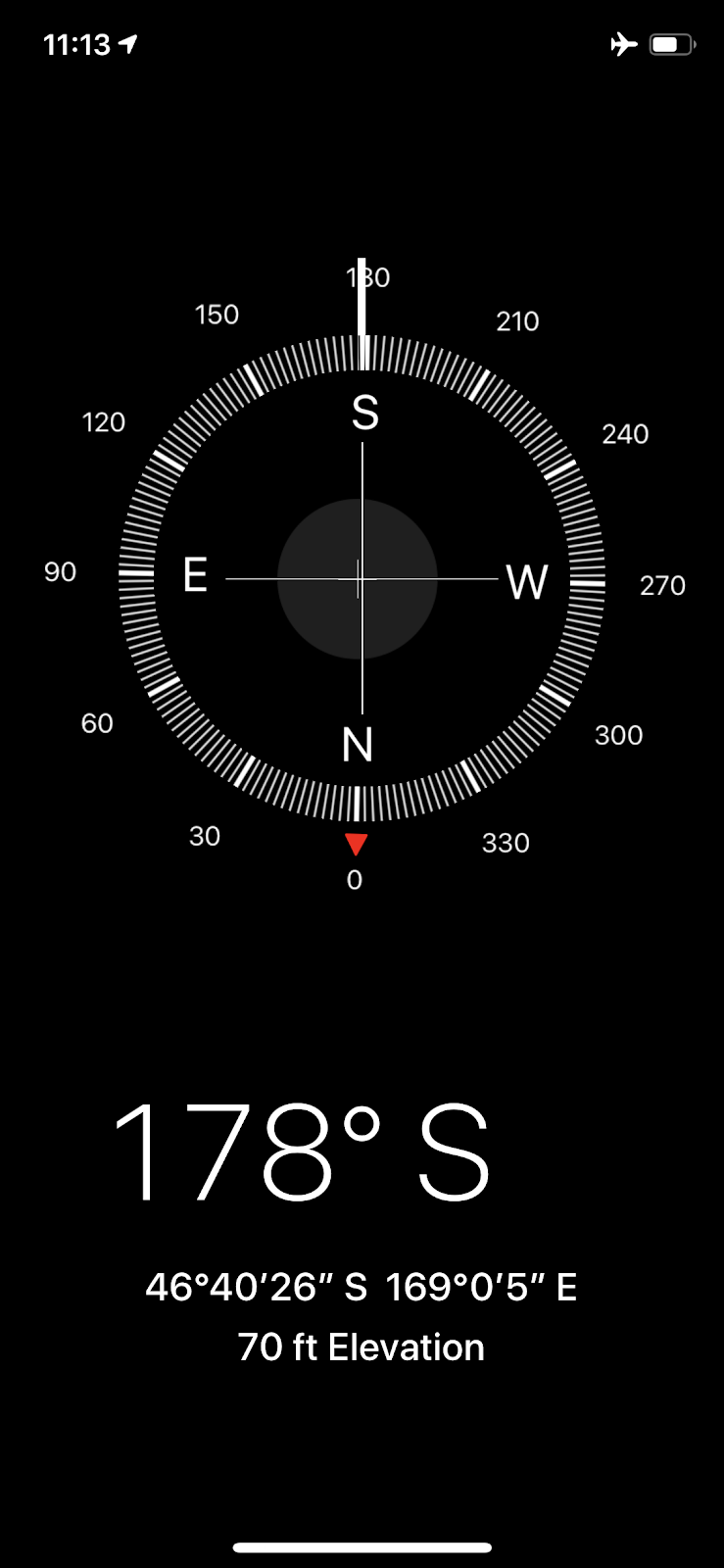
Thursday was quite similar: slow and scenic. Our first stop was the southernmost point of the south island and also the southern extreme of our worldwide tour. The latitude is nearly 47 degrees (south). Coincidentally, our home is at about 45 north and we spent the summer in northern Minnesota at roughly 47 degrees north!
 |
| Wally in a setting he said could be borrowed from Ireland or Scotland |
 |
| Lily and the wind |
 |
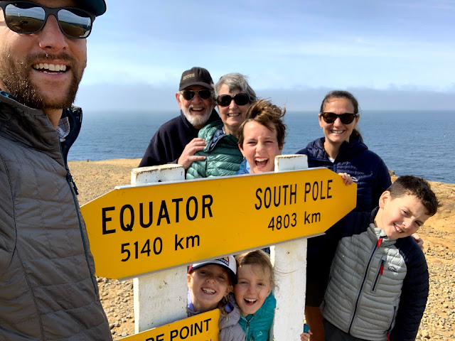
| Our southern maximum |
 |
| We owe the smiles in this picture to the puffy coats we bought at LL Bean back in September! |
 |
| Screenshot to prove it |
 |
| 16 feet. |
 |
| Seriously, can you imagine seeing this sign at a trailhead in America? |
 |
| No wonder Kiwi's call this "tramping" |
We reached Invercargill for lunch, where we also restocked our groceries and visited Queens Park, which was extraordinary. It afforded the kids a chance to play concurrent with the shopping.
 |
| Castle Playground in Queens Park, Invercargill |
 |
| The sign says that this fountain was unveiled by the Queen Mother. Truth! |
That left us with a two hour drive to reach our day's destination, Te Anau. In the course of this day, we left the rolling hillside and traversed a plain that reminded us of Nebraska before entering the southern edge of NZ's alpine territory, with steep mountains plunging into cold lakes.
 |
| *sigh* |


Comments
Post a Comment